Dr Kadmiel Maseyk
Senior Lecturer In Environmental Sciences
School of Environment, Earth & Ecosystem Sciences
Biography
Research interests
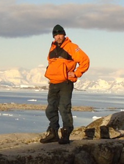
I am a plant ecophysiologist interested in how plant function affects ecosystem carbon and water biogeochemistry. I have a stong interest in plant and ecosystem responses to environmental variability and global change processes. My work is predominantly field based, and has covered environments from the poles to the tropics.
Projects
ECT/ Ramble Worldwide outdoor trust joint maintenance
The maintenance and upgrade of the irrigation equipment providing the +50 % rainfall treatment into the second decade of the RainDrop rainfall manipulation experiment on calcareous grassland, Oxfordshire.
Branching out: New routes to valuing urban Treescapes
Urban trees contribute many valuable things to society. Some of these, like carbon storage, are relatively easy to measure and assign a value to, while others, such as cultural or historical value, are less tangible. The Branching Out project is a major interdisciplinary project led by Loughborough University and including the Open University, University of York and Forest Research that will investigate a wide range of social and cultural values of urban trees. The project will use participatory methods to understand what diverse communities value about urban trees and map these values across urban areas using citizen science and the latest satellite imagery analysis methods. By working with urban tree managers we will be able to improve the management of urban forests to maximise their benefits to society.
Enhancing community-led malaria control in escalating climatic disruptions through automated cross-scalar environmental information systems
Mosquito-borne diseases have a major impact on developing countries. In 2018, there were an estimated 228 million cases and 405,000 deaths from malaria alone. DETECT will integrate satellite, air-borne and ground-based sensing to detect where mosquitoes are most likely to breed. Through satellite communications, our system will then dispatch ‘sprayer drones’ to these high-risk areas to release biocontrol agents - killing mosquito larvae without affecting other species. The Discovery Phase will co-design a community-based service with the Indigenous community of Yupukari, Guyana, and engage stakeholders from within Guyana and beyond in planning for outscaling.
UAV-based Tree Health Management Platform: Ash Dieback
Emerging technology from the agri-tech sector will be deployed in the Project. The physiology and structure of tree canopies can be estimated by measuring the reflected light with specialist sensors. By combining this information with expert knowledge of ADD, we can produce predictive models of ADD and other tree diseases. This Project will investigate how these models are integrated with decision support systems for informing management of England's Ash trees, developing an affordable solution to benefit smaller woodland owners in identify disease infestation, to allow them to take proactive intervention measures
TreeLab: a novel, engaged, urban forest research programme
This project brings together an inclusive leadership team that includes leading researchers in urban forestry, citizen science and engaged research to co-create a proposal for the development and implementation of TreeLab: a framework and delivery programme for an engaged, and collaborative world-class urban tree research project that will co-produce an evidence base for urban tree management. We will co-create the TreeLab concept through TreeLab:MK, using the city of Milton Keynes and engaging its communities of tree managers, publics and researchers in the development of a place-based nationally and internationally relevant research programme for phase 2 of this call.
Quantifying patterns in urban tree canopy cover and identifying causes of urban tree loss
In overview, the proposed Project will construct a Research Plan comprising two work areas with the following scope: Work Area 1: Canopy Cover and Trend Analysis WA 1.1: Canopy cover mapping: historic WA 1.2: Image-based tree mapping: historic and contemporary, including verification of remotely sensed (RS) data WA 1.3: Integration of tree maps for geospatial and trend analysis Work Area 2: Understanding and Valuating Change WA 2.1: Reasons for change WA 2.2: Valuing canopy cover change
Methane Production in the Arctic: Under-recognized Cold Season and Upland Tundra- Arctic Methane Sources-UAMS
This project will refine understanding of the current magnitude of methane emissions from the Arctic. In particular, emphasis will be placed on the processes currently under- represented and poorly understood in concerning Arctic methane (CH4) balance. These are: a) the role, magnitude, and processes where by methane is released from non-inundated tundra or “dry tundra” and b) the role of cold season in annual CH4 emissions. The project will incorporate this new understanding in three major models JULES, LPJ, and TCF. Special emphasis will be placed on understanding processes including how, despite much conventional wisdom, poorly inundated tundra can be a major source of Arctic methane emissions, in some cases greater than those of inundated tundra. The overarching objective is to improve our ability to estimate current and predict future CH4 fluxes in the Arctic by improving understanding of the temporal and spatial control on CH4 flux.
Earth Observation enabled responsive climate adaptation for the Kalahari Basin
The increasing length (in time) and coverage (in area) of remote sensing or Earth Observation (EO) data and EO products is having a large impact on the way we understand and offers the potential for new ways of managing our environment. Much of this data and information is now freely available and increasingly accessible to the global population, providing immense new opportunities for developing countries. Ongoing global warming, which is likely to reach 1.5°C in the next decades, will have significant impact on the rural communities of sub-Saharan Africa, which are reliant primarily on rain-fed crop and livestock farming, typically on small plots of land. However, these communities have limited knowledge of, and adaptive capacity for, climate change scenarios, and therefore are at risk of chronic food insecurity and disproportionate suffering from climatic variability, despite having probably contributed least to global warming. The ultimate goal of the project we wish to develop is to make more effective use of the vast amounts of increasingly accessible EO data to underpin the early-warning, planning, and management of climate extremes in some of the most vulnerable regions of Africa. We will use the network grant to a) develop a network of researchers in sub-Saharan Africa, and b) identify the requirements and needs of, and methods for communication this information to, the relevant rural communities. We will hold a project scoping and network building workshop in Botswana, where will bring together potential project partners to identify the key agro-ecological/livelihood zones in the Kalahari Basin region; the requirements in terms of information that will help resilience planning for these communities; and effective methods of communicating this information to the communities. Preliminary data collection ahead of the scoping workshop will involve some region-specific stakeholder participatory workshops (2-3, budget depending). The information and outputs from the above activities will be drawn together to start bid development, which will be possibly included as an activity in the networking grant. Identified institutions that will be invited to participate in the project include: University of Botswana, Botswana; University of Kinshasa, DR Congo; University of Dar es Salaam, Tanzania; Economic and Social Research Foundation, Tanzania; Midlands State University, Zimbabwe, and the African Technology Innovation Hub Initiative (AfriLabs), Nigeria. In each we have already made contact with relevant individuals.
TreeView Phase 2
TreeView is an Earth Observation mission that will achieve precision forestry from space in the support of Nature-Based Solutions to tackle climate change. The expansion of tree cover is a critical component of the path to net zero but reaching this target will require extensive management of this resource. Through leveraging next-generation optical sensor technology and innovations across the payload and spacecraft development, TreeView will provide multispectral data at a ground sampling resolution on the scale of individual trees, providing measurement and monitoring capabilities at an unprecedented level. The proposed project builds on the successfully concluded feasibility study and will progress the hardware and software elements of TreeView to a Preliminary Design Review (PDR). The activities will focus on the development of the instrument from an initial concept to a finished design. The satellite bus is being developed and qualified through a European Space Agency funded project and has already passed its PDR. A mission specific “delta” PDR will be held in future phases of the TreeView programme once the payload PDR’s have also been passed to confirm the complete satellite is at sufficient design maturity. The data processing pipeline embodied largely in the Ground Segment, and outputting data products for dissemination, raw data for archiving and utilising ground validation will be reviewed in a Ground Segment PDR. Subject to further funding, the outcome of this project and a successful PDR will enable the TreeView team to commence procurement to develop the Engineering Model of the instrument and payload for the TreeView mission. In parallel spacecraft procurement and development of the Ground Segment through a model of commercially purchased services, national facilities, and support from the science team could commence. TreeView is on track to develop and launch the satellite and return data by the end of the Financial Year 2024-25.
Climate change impacts on a calcareous grassland: monitoring the abiotic environment
Understanding the impacts of climate change on sensitive and high-conservation value ecosystems is essential for their successful management and provision of ecosystem services. We have recently established a large field-based experimental facility to investigate the impacts of changing hydrological regimes on a calcareous grassland, ecosystems of high conservation value in the UK. The experimental set-up, at the Upper Seeds experimental site, Wytham, Oxford, involves four 5 m x 5 m treatment plots within five 30 m x 20 m blocks to investigate the impacts of both decreased and increased rainfall on the ecosystem. To fully leverage the potential of this platform requires a comprehensive understanding of the microclimate conditions within the treatment plots and the effects of the imposed treatments. This project will instrument the platform with sensors for environmental monitoring. Sensors will be used to monitor soil-water content and temperature, as well as radiation, air temperature and humidity beneath the shelters. Support has been secured from the ECT via Oxford University, and is match funding of internal EEES School support.
[SPRINT] High spatial and spectral resolution tree mapping and identification
We will combine measurements across scales from ground-level, UAV and airborne platforms of urban and woodland environments. Using high-resolution imaging and non-imaging spectroscopy we will develop training data for the identification and physiological characterisation of tree species in both urban and non-urban environments. The ultimate goal is to develop an approach that can be applied to emerging very high resolution satellite platforms for monitoring trees and forests from space.
TreeView: developing new capacity for the remote sensing of UK trees and forests
Tree and forest climate interactions are fundamental to a sustainable future and societal wellbeing. Trees are at the heart of the current political discourse, and the UK government is preparing to launch a strategy to accelerate tree planting and improve the management of existing trees and woodlands. The world is becoming increasingly urbanised, and urban trees are well recognised for their environmental, health and wellbeing benefits. Trees across the rural and urban landscape are going to play a central role as we move towards a net-zero emissions economy. The ability to measure, monitor and map the health and status of the UK’s trees is therefore essential to the UK’s future treescape and urban green infrastructure. Currently, tree identification can be achieved with high spatial resolution panchromatic imagery, but we need to go beyond this. We need to be able to not only map species within mixed assemblages, but also characterise the health and size of the trees. Furthermore, we need to be able to measure the particular configurations of urban environments and the small-scale but widespread plantings that are likely to feature prominently in planting programmes. Importantly, we need to be able to monitor changes over time – to quantify carbon sequestration; assess vulnerability and detect the onset of climatic stress or disease outbreak to facilitate early intervention; and to measure the success and monitor compliance of tree planting programmes. This requires going to the spatial scale of tree crowns but capturing the spectral information that will provide the information for classification and characterisation. Advances in both sensors and process understanding is closing the gap between canopy reflectance properties and its functional meaning, opening the possibility of detailed studies at the scale of individual trees and their responses to global change from space. Species identification and mapping has been demonstrated from airborne hyperspectral sensors, enabling species mapping across forests and urban areas. In this project we will push the limits of leading CMOS TDI sensors and optimise system configuration to develop a new platform for the classification, characterisation and monitoring of trees across urban and rural landscapes. Band selection will provide information on both plant health and will feed into classification algorithms developed from extensive ground truthing data. In this pathfinder phase of the project, our objectives are to (could include): 1. Refine band selection based on key vegetation characterisation indices and sensor constraints (from starting point of bands a,b,..f) 2. Develop classification algorithms from airborne hyperspectral data and extensive ground-truthing data sets. 3. Collect new airborne data specifically for one target market: railways 4. Produce the system requirements document for TreeView 5. Produce the mission requirements document for TreeView 6. Perform market analysis of end users across local and national government, commercial and research sectors
Climate Change Impacts on a Calcereous Grassland
Understanding the impacts of climate change on sensitive and high-conservation value ecosystems is key for their successful management and provision of ecosystem services. This project will establish a large field-based experimental facility to investigate the impacts of changing hydrological regimes on a calcareous grassland. The experimental set-up involves the construction of up to 16 large rain-shelters, combined with irrigation systems, to apply both drought and wetting treatments to a grassland ecosystem at the Upper Seeds experimental site, Wytham, Oxford. Planned as a platform for long-term ecological experiments, it will host over time a number of research projects from different institutions, with a PhD project from the OU and a DroughtNet-linked project from Oxford due to start field work in spring 2016. This bid is to finalise the construction of the shelters, following prototype trials at the OU. Funds have already been secured for shelter construction from the Patsy Wood Trust through the ECT; decisions on the initial number and time-frame for remaining shelter construction are required for this stage. This project is the continuation of an earlier project initiated by Jonathan Silvertown under budget code HGSE 4240 C4509.
The impact of hydrological change on carbon fluxes and soil bacterial biomass in a species-rich calcareous grassland
This is a summer student project, under the NERC Research Experience Placement (REP) scheme. The aim of this project is to investigate the impact of the different hydrological treatments on soil microbial biomass and soil-atmosphere carbon fluxes at the RainDrop experimental site. The primary hypotheses the student will be tasked with testing are: 1) CO2 production decreases under the drier and increases under the wetter conditions; 2) methane uptake increases under the drier and decreases under the wetter conditions; and 3) CO2 fluxes are coupled to and methane fluxes decoupled from changes in microbial biomass carbon. The rationale underlying these hypotheses is that the well understood response of soil respiration to soil moisture is associated with changes in total microbial abundance in this system, as opposed to inactivation of the communities, and that methane uptake increases with drought due to greater porosity of dry soil and reduces under wetter conditions due to diffusive limitations and methanogenisis at anoxic sites in the wet soil.
Publications
Journal Article
Examining anomalous summer carbonyl sulfide emissions in a boreal forest after thinning (2026)
Experimental drought reduces the productivity and stability of a calcareous grassland (2024)
Farmer preference for macadamia varieties and constraints to production in Malawi (2024)
Factors affecting soil quality among smallholder macadamia farms in Malawi (2023)
Soil carbonyl sulfide (OCS) fluxes in terrestrial ecosystems: An empirical model (2022)
Evaluation of carbonyl sulfide biosphere exchange in the Simple Biosphere Model (SiB4) (2021)
Teaching and learning in ecology: a horizon scan of emerging challenges and solutions (2021)
Complexity revealed in the greening of the Arctic (2020)
Influences of light and humidity on carbonyl sulfide-based estimates of photosynthesis (2019)
Reviews and syntheses: Carbonyl sulfide as a multi-scale tracer for carbon and water cycles (2018)
Stomatal control of leaf fluxes of carbonyl sulfide and CO2 in a Typha freshwater marsh (2018)
Assessing a New Clue to How Much Carbon Plants Take Up (2017)
Canopy uptake dominates nighttime carbonyl sulfide fluxes in a boreal forest (2017)
Resilience to seasonal heat wave episodes in a Mediterranean pine forest (2016)
Litter dominates surface fluxes of carbonyl sulfide in a Californian oak woodland (2016)
A soil diffusion–reaction model for surface COS flux: COSSM v1 (2015)
Sources and sinks of carbonyl sulfide in an agricultural field in the Southern Great Plains (2014)
High Arctic wetting reduces permafrost carbon feedbacks to climate warming (2014)
Presentation / Conference
Embedding research into teaching: practices, motivations and impacts (2023)
Presentation / Conference Contribution
Co-creating hypotheses with students during short field investigations (2025)
Changes in ancient woodland flora after rapid urbanisation of surrounding landscapes (2023)
Broadcasting from the field: enabling student-led investigations by distance (2020)
Widening access to fieldwork for large numbers of students with interactive livecasts (2018)
Live field broadcasts: Moving from optional additions to required assessment (2018)
Widening access to fieldwork with interactive livecasts (2016)


